International Archaeology, LLC (IA) provides a broad range of cultural resource management services to individuals, businesses, and government agencies. In addition to archaeological surveys and assessments, data recovery, and monitoring, we offer historical studies, preservation and interpretive planning, National Register of Historic Places (NHRP) nominations, Geographic Information Systems (GIS) studies, oral history, and cultural impact assessments. Our in-house specialized technical services include paleoenvironmental coring, bioarchaeological (osteological) and zooarchaeological analyses, wood identification, chronological modeling, GIS services, drone photography, and photogrammetry.
We are committed to providing the highest quality cultural resource management documentation. Our technical reports include well-researched archival and literature reviews, clearly written fieldwork and laboratory summaries and analyses, and informed and well-reasoned interpretation of findings. Documents produced by International Archaeology are professionally edited and adhere to state and federal standards.
PLANNING
Our staff has planned large and small historic preservation projects throughout the Pacific Islands. We are well versed in local, territorial, state, and federal laws that guide the preservation of historic properties in Hawai‘i, Guam, American Sāmoa, the Commonwealth of the Northern Mariana Islands, the Federated States of Micronesia, and the Republic of Palau. We are also experienced in the interface of U.S. laws with local and national historic preservation regulations in Japan and South Korea.
In Hawai‘i, the State Historic Preservation Department (SHPD) has issued a set of rules and regulations to guide the preservation of historic sites. We provide assistance to property owners and developers in understanding how their plans for land use might be affected by compliance with historic preservation regulations, communicating with the SHPD, compiling information on the presence of historic and prehistoric sites, evaluating past assessments and findings, and discussing the potential for additional sites to be encountered. Our staff can carry out on-site archaeological evaluations and advise on the process of mitigation to help clients consider the potential related costs.
Cultural Impact Assessments
Traditional cultural properties and practices are resources or activities that may be important to Native Hawaiians, other Pacific Island peoples, or other local communities. Cultural Impact Assessments (CIAs) consider the potential effect of a land use change or development project on traditional cultural practices and resources through background historical, cultural, and ethnographic research and community consultations. We have extensive experience performing cultural impact assessments in Hawai‘i, Guam, the Northern Marianas, and other locations in the Pacific Islands. CIA reports prepared for properties in the State of Hawai‘i comply with Office of Environmental Quality Control Guidelines for Assessing Cultural Impacts. Review the guidelines.
Work Plans
Before undertaking most archaeological investigations, a detailed work plan must be prepared and accepted by a local, state, or federal agency. We use information about known resources in the project vicinity, combined with knowledge gained over decades of experience in Hawaiian and Pacific Island archaeology, to determine whether cultural resources might be present on a parcel and what field methods are best suited to a particular project. Much of this work relies on our extensive directory of GIS data pertaining to known archaeological sites and previous investigations. Our work plans assess the environmental, cultural, and archaeological background of the project location, and detail project-specific procedures for field and laboratory investigations to ensure the work meets local, state, and/or federal requirements. The work plans we develop are guided by research questions, which are then assessed in the final report to the client.
Burial Recovery Plans
Sometimes human skeletal remains are identified while doing archaeological surveys, data recovery excavations, or monitoring. Our Senior Archaeologists and Bioarchaeologists are experienced in a process that requires preparation of a plan for appropriate and sensitive disposition of the skeletal remains and involves consultation with members of the Native Hawaiian community, SHPD, island burial councils, and other government agencies. Our burial plans meet the requirements specified in the Hawai‘i administrative rules by providing the requisite project and background information, a summary of consultation efforts, the proposed final disposition for the remains (preservation or re-location), and proposed short- and long-term protective measures.
We have several Senior Bioarchaeologists on staff for identifications, skeletal inventories, and more detailed analyses. These professionals have experience with culturally sensitive osteological studies, and have been involved in burial treatment projects throughout the Pacific Islands and Pacific Rim.
Preservation and Management Plans
Preservation and Management Plans are documents designed to facilitate management of cultural historical resources. They present detailed reviews of all information known about cultural resources in an area, including descriptions of the strengths, weaknesses, and completeness of the archaeological inventory, the significance of the resources, and identification of any threats to the resources as the basis for procedures and protocols that the landowner or land steward will use to protect and preserve the resources. Examples include Archaeological Overview & Assessments, Integrated Cultural Resources Management Plans, and Historic Preservation Plans. Our staff has experience preparing extensive cultural resource management plans for private and federal clients in Hawai‘i and numerous other locations in the Pacific Islands.
Research Designs
A research design develops a synthesis of current archaeological, ethnographic, oral history, and other data for a project or geographical area (e.g., a national park). It describes the questions to be evaluated and provides a framework to guide the research process. A research design may frame questions relevant at a local-scale (e.g., chronology of development of a particular agricultural field system), island- or archipelago-scale (e.g., development of dryland cultivation practices in an archipelago), or regional-scale (e.g., selective factors for the establishment of various agricultural methods in Oceania). Such documents aid in the implementation of specific projects and can also be a key component in the development of a management plan for organizations and government agencies.
Many of our senior staff members are experienced researchers, well versed in designing and conducting archaeological research that is relevant to present-day concerns.
Case Study: Traditional Marine Subsistence and Ecology in Ka‘ūpūlehu Ahupua‘a, Hawai‘i Island

The aims of this project were to utilize an archaeological collection curated by Kamehameha Schools and to assist the Ka‘ūpūlehu Marine Life Advisory Committee (KMLAC) by determining the effects of historic and modern fishing on population sizes, and to reanalyze the artifact and faunal collections to identify one component of traditional Hawaiian dietary patterns and associated food procurement technologies. The zooarchaeological collections reanalyzed for this project were generated by historic preservation compliance projects in the 1980s and 1990s in North Kona.
The results of this research will aid in the development of a management plan for sustainable fishing and invertebrate collection within the Ka‘ūpūlehu Marine Reserve. These results will also contribute to knowledge about traditional marine resource use, ecological knowledge, and subsistence practices in Hawai‘i. The project provides an example of how to integrate datasets drawn from archaeology, ethnography, oral history, and fisheries biology into an applied management strategy. Additionally, the project highlights the use of curated archaeological collections and therefore operates from an archaeological conservation ethic.
ASSESSMENT & MITIGATION
Archaeological
Inventory
Survey
Before development plans or permits may be approved for a property, the state may require an Archaeological Inventory Survey (AIS) to be conducted. These surveys are designed to identify and evaluate all cultural resources in the project area. This is done through review of historical documents and maps, pedestrian survey, and often subsurface testing. Results are presented in a technical report and all finds are evaluated for significance following state and/or federal criteria. AIS reports are reviewed by the State Historic Preservation Division (SHPD) to ensure adherence to relevant rules. If archaeological sites are present, we will coordinate with the SHPD on the most appropriate mitigation measure (i.e., preservation, archaeological monitoring, and/or data recovery).
Data Recovery
The impacts of development on previously identified cultural resources can be mitigated through recording, excavation, and analysis. Data Recovery is designed with the aim of better understanding resources identified during inventory survey and testing. Work can include excavation, mapping, documentation, and descriptions. It typically also involves some laboratory analyses of the materials recovered. This work is necessary when resources evaluated as significant under one or more state and/or federal criteria are to be disturbed or destroyed. Data Recovery is guided by a work plan that defines the research questions to be addressed, what will be investigated, and how the work will be carried out. It is created in consultation with various stakeholders, and approved by the SHPD or federal agency clients.
Staff at International Archaeology has experience conducting data recovery projects of all sizes which include:
- Historical research that can inform on site function and context
- Detailed recording and surface collection
- Manual and mechanical excavation
- On-site analysis of human skeletal remains
- Specialized analyses of plant materials; faunal bone and shell; lithic, bone, and shell artifacts; ceramics; historical artifacts; and soils
- Through our specialist consultants we provide radiocarbon dating, plant microfossil, geochemical, isotopic, and ancient DNA analyses


Archaeological Monitoring
When development or natural forces have the potential to disturb cultural resources, archaeological monitoring may be required as a mitigation measure. Monitoring is conducted under the guidance of a detailed work plan that is approved by the SHPD or federal agency. Plans are designed to prepare clients and monitors by providing summary information on the cultural and natural histories of the area, known cultural properties, and past archaeological research conducted in and around the project area, along with detailed procedures for fieldwork. Archaeological monitors inspect subsurface work at a job site with the aim of identifying and documenting any resources that are encountered. A report on monitoring activities and project findings is produced at the conclusion of a project.
Our staff has prepared high-quality monitoring plans for construction, development, and emergency projects of all sizes throughout the Pacific Islands. We have provided monitors on short notice for emergency work as well as for long term, multi-year projects. In one case, IA mobilized an archaeological monitor from Hawai‘i to American Sāmoa within a week’s notice to assist with a federal emergency project. International Archaeology has experience collaborating with contractors, government personnel, and community leaders to achieve consensus on the appropriate and timely handling of sensitive cultural resources.

Emergency roadworks, Ka’a’awa, O’ahu
Waves from large winter swells critically compromised the road surface of Kamehameha Highway on O‘ahu’s windward coast, and archaeological monitoring and emergency data recovery services were provided to HDOT. IA provided services that included documentation of soil profiles exposed by coastal erosion, data recovery excavations, and laboratory analyses. These data provide information about traditional habitation in the Makaua area including the spatial distribution of activities, types of activities and materials used, and the chronology of occupation.
Preservation Planning
Following the identification and documentation of significant archaeological sites, preservation may be the preferred mitigation action. We work closely with our clients and the SHPD to determine and implement the best, project-specific preservation measures. These measures are clearly described in a preservation plan that adheres to state rules. The plan specifies the preservation area, allowable actions within and around the preservation area, consultation efforts, and short- and long-term protective measures.
TECHNICAL SERVICES

Geographic Information Systems (GIS)
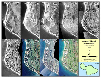
A good quality, reliable repository of locational data is critical to modern archaeological investigations. International Archaeology has several staff members with advanced GIS skills including data generation, data management, spatial analysis, and cartography. Field data are created using our professional-grade Trimble GPS units, camera-equipped drone, and other low-elevation photographic methods. For each project, GIS data is differentially corrected for sub-meter accuracy, exported as shapefiles, and plotted on a USGS topographic quadrangle maps. A variety of private and publically-accessible maps are also integrated with these data to provide a thorough understanding of how cultural resources might be affected by past, present, and planned land use.
BIOARCHAEOLOGICAL SERVICES
International Archaeology has several qualified biological anthropologists who are available to identify osteological materials (bone) on call and assist in reinterment planning. These services conform to state and federal guidelines. Our team also has extensive experience consulting with Native Hawaiian descendants to ensure human remains are handled respectfully.
DRONE PHOTOGRAPHY
Drones (small unmanned aircraft systems or sUAS) are innovative tools used by archaeologists to fly close to terrain and record features. This technology provides unique and new perspectives on archaeological landscapes. It also allows for the inspection of areas that are difficult to access in person. IA has an FAA-qualified drone pilot and technicians that are experienced in post-processing drone imagery.
FAUNAL ANALYSIS
Zooarchaeology is the study of animal remains (bones, teeth, scales, shells, etc.) recovered from archaeological sites. Our staff provides an array of services that include sorting, taxonomic identification, and statistical analyses.
PHOTOGRAMMETRY
Photogrammetry is a documentation technique that turns digital photographs into 3D models. Pictures of very small objects, excavation units, and even entire landscapes can be processed to create spatially accurate renderings.
PALEOENVIRONMENTAL STUDIES
Our senior staff has extensive experience extracting and analyzing sediment cores from wetland sites for paleoenvironmental studies. We work closely with associates who conduct pollen and other plant microfossil analyses, diatom identifications, and soil geochemistry to produce reports that detail past environmental conditions. International Archaeology has carried out paleoenvironmental studies in locations throughout the Hawaiian Islands, Micronesia, and elsewhere.
WOOD IDENTIFICATION SERVICES
For over 30 years, the Wood Identification Laboratory has analyzed materials from Hawai‘i and throughout Polynesia, as well as Micronesia. Services provided in our Honolulu office include taxonomic identification of charcoal samples, assistance selecting short-lived material for radiocarbon dating, processing bulk sediment samples to extract botanical materials, and identification of wooden artifacts. Detailed descriptions and pricing of these services are outlined in our [brochure] and [submission form]. Direct inquiries to [email protected].
3D LASER SCANNING
3D scanning quickly and accurately converts a physical object into a precise digital model. This technique is used by archaeologists to precisely document materials ranging from fragile bone to one-of-a-kind artifacts, providing the opportunity to study objects that have been repatriated or returned to storage or displays.
CURATION SERVICES
We also provide curation services to help clients inventory and manage cultural heritage collections, repatriate materials that will not be retained, coordinate research on curated collections, and plan educational and interpretive displays.
INTERPRETATION & OUTREACH
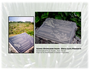
Interpretive Signage and Literature
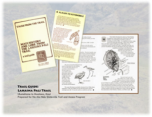
Interpretive signage and literature bring the results of archaeological research to the public. They provide a means to share scientific outcomes as well as to promote an appreciation for cultural resources and the historic preservation process in general. Public interpretation is also a means to mitigate the adverse effects to significant cultural resources when such impacts cannot be avoided. Our staff has developed interpretive programs that include trail signage, educational brochures, and interpretive guides and books. We have experience collaborating with state and federal agencies and educational institutions to create materials intended for public use. We can develop a strategic framework and key messages, write original copy, design artwork and layouts, locate archival images, and develop a plan for implementation.
National Register of Historic Places & National Historic Landmark Nominations
The National Register of Historic Places (NRHP), administered by the National Park Service, is an official list of significant historic places in the United States. To be considered eligible, a property must meet the NRHP Criteria for Evaluation, which involves assessing its age, integrity, and significance. Properties accepted to the NRHP represent significant aspects of our local and national heritage. They are tangible monuments of significant periods or events in our country’s history, from the mundane—such as an early 20th century Chamorro farmstead on Guam—to the extraordinary—the grand Pu‘ukohola heiau (temple) on Hawai‘i Island. International Archaeology has worked with numerous clients in helping with documentation efforts, significance evaluations, and preparation of NRHP nomination form for simple to very complex properties. IA staff have prepared successful NRHP and National Historic Landmark nominations for properties in Hawai‘i, Guam, and American Sāmoa.
